Parque Natural de Urkiola · Ayuntamiento de Abadiño
Situación
Menú principal
Situación
Menú principal
Hiking is one of the best ways to discover a natural areas and Urkiola Natural Park offers us the ideal setting to enjoy that outdoor activity. The Urkiola mountains have a large network of paths that follow old bridleways, traditional mountain routes and new paths that have been created after the area was declared a natural park.
Abadiño has two main access points inside the Park to many routes: Urkiola Pass and the Atxarte ravine.
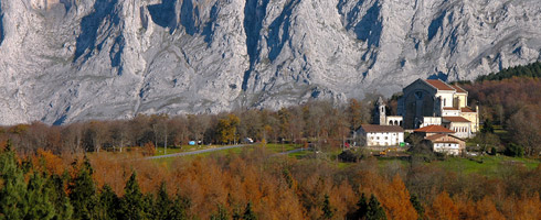
Urikola is a very popular place with pilgrims, mountaineers and day-trippers alike. At over 700 metres high, it is located in the middle of the Park and is surrounded by a stunning mountain landscape made up of rocky peaks, pasture lands and leafy beech forests.
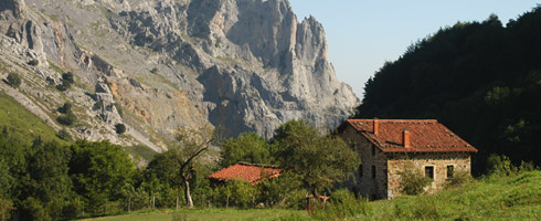
The Atxarte ravine is in a stunning setting and is surrounded by huge limestone rock walls studded with magnificent climbing routes. Despite the abandoned quarries, the place still retains its charm. Some of its main features are a small stream with crystal clear water, the Santo Cristo Chapel, an old stone bridge, the remains of an ancient mill and some caves where prehistoric remains were found.
The recommended routes are the ideal opportunity to discover Urkiola’s cultural, historical and natural importance. There is a wide range of routes to choose from, from simple educational routes to the traditional mountain ascents, which are physically more demanding. You can also combine some of the recommended routes. One such option would be to climb up from Atxarte to Urkiola through Txakurzulo and then continue on the Urkiolagirre route and then go down to Atxarte from Asuntze.
2006 - 2007 © Anteiglesia de Abadiño Town Council - All rights reserved